DigitalGlobe SeaStar Fisheries Information Service
Save time & fuel
The SeaStar Fisheries Information Service offers clients an easy way to view real-time and forecasted oceanographic and meteorological data maps derived from satellite ocean observation systems. Our services are used successfully by pelagic fishermen to minimize search time and reduce fleet operation costs. SeaStar oceanographic products are processed daily and delivered directly to subscribers at sea for viewing on the ship’s personal computer. Combined with local fishing knowledge, captains use the SeaStar maps to navigate directly to the closest and potentially most productive fishing areas. To maximize the use of the information, DigitalGlobe provides software training and technical support.
 |
The SeaStar advantage
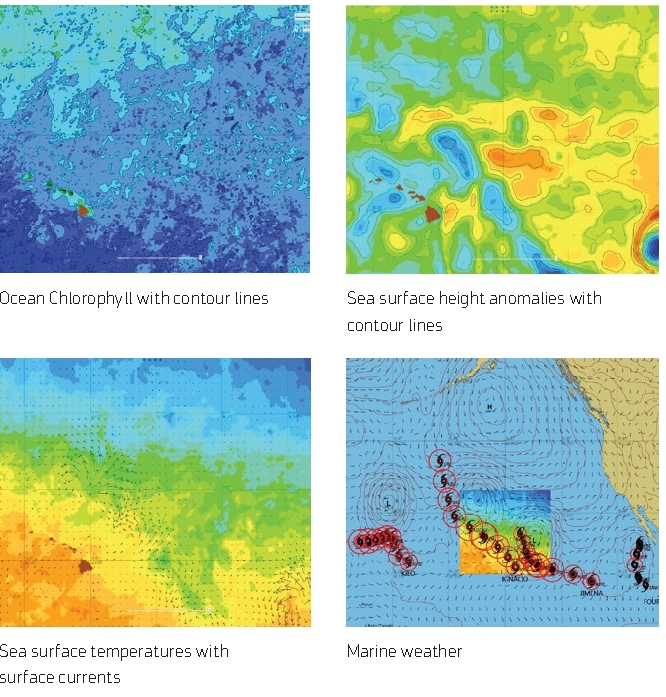
DigitalGlobe creates SeaStar fish-finding maps from several ocean observing satellite systems and other scientific marine sources.
SeaStar map include:
- Ocean chlorophyll concentrations(ocean color)
- Sea surface temperatures
- Sea surface currents
- Sub-surface temperatures
- Thermocline depth
- Sub-surface currents
- Sea surface height anomalies (altimetry)
- Ocean salinity
- Comprehensive marine weather and forecasts
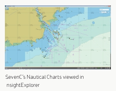
Display and interpret the ocean and weather condition with InsightExplorer software, other advantages include:
- SevenCs™ nautical charts with navigation tools
- Fish Catch Reporting
- MasterCast™ fishing ground analysis tool
- Oceanographic analysis and recommendations
SeaStar Services
SeaStar Pro Service
Provides a full suite of oceanographic and weather information available on a daily basis. Captains can use the InsightExplorer software for viewing and manipulation of SeaStar map data to quickly identify areas where fish are likely to concentrate.
SeaStar Weather Plus+ Service
DigitalGlobe offers a stand alone weather data package that includes weather bulletins, barometric pressure, winds, wave height, swell and up to a 10 day forecast.
InsightExplorer software with MasterCast
With the easy-to-use software, captains can combine their local knowledge with the SeaStar map data to make informed operational and fishing decisions. Training and technical support is available from DigitalGlobe staff, international agents, and business partners.